
The Archives is very pleased to announce that the Planning Department’s former reference library material is now available to researchers in the Archives’ Reading Room.
The series consists of almost 1,200 items, including a set of Information Binders created by the department containing clippings, reports, pamphlets, etc. organised by topic or neighbourhood.
All areas related to planning are included in the series. The best documented subjects (as you would expect) relate to City-specific responsibilities: transportation planning, zoning and land use planning, building and urban design guidelines, urban renewal/redevelopment, and housing.
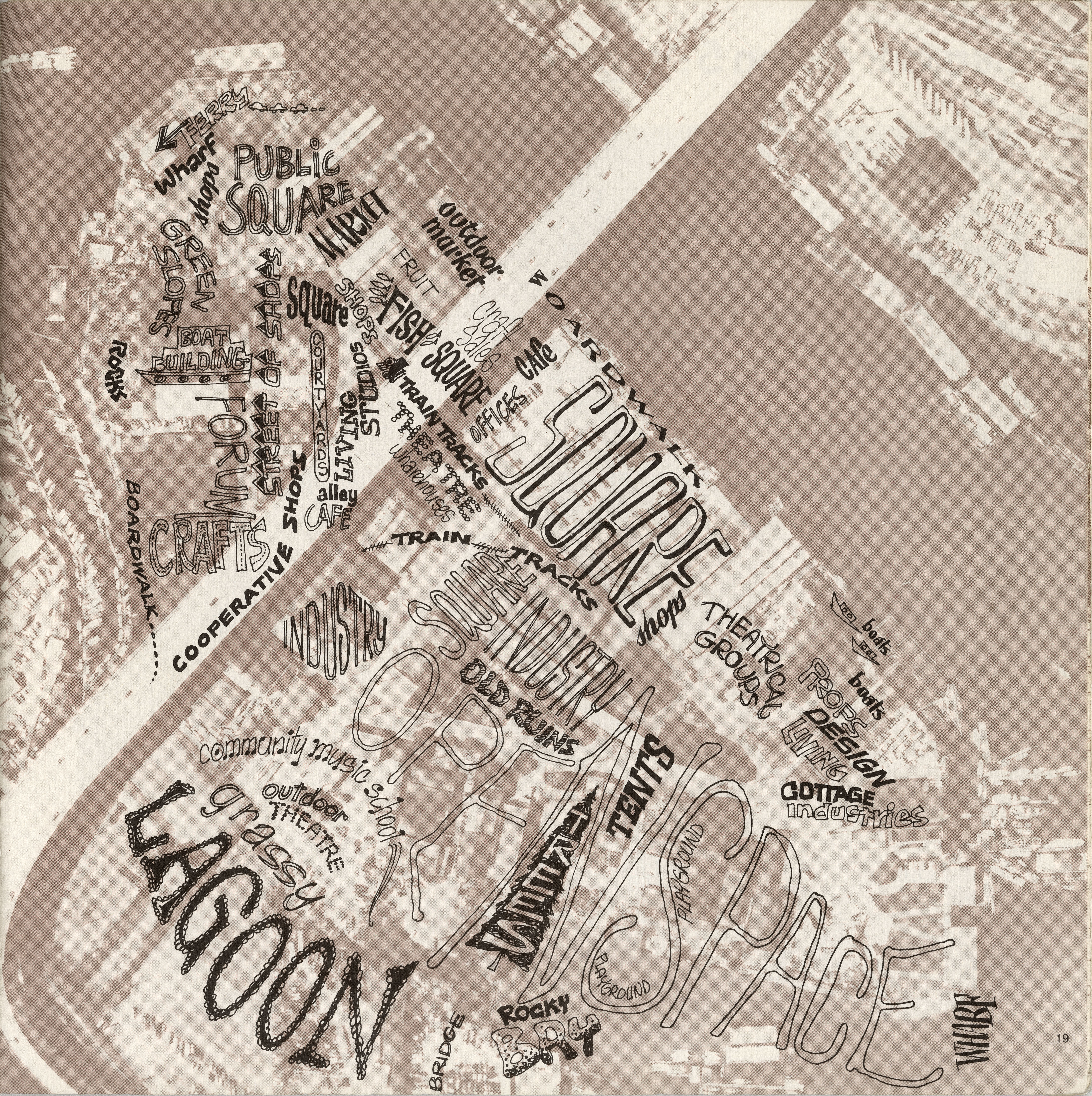
Other related subjects include: economic development, recreational resource planning (in conjunction with the Park Board), unsolicited studies on a number of matters related to planning, proposals for individual buildings and larger developments, and Vancouver’s participation in regional transportation development.
While the dates of the material in the series range from the 1920s to the early 2000s, the bulk of the items are from the 1960s to the early 1990s, with items from the 1970s alone making up 49% of the series.
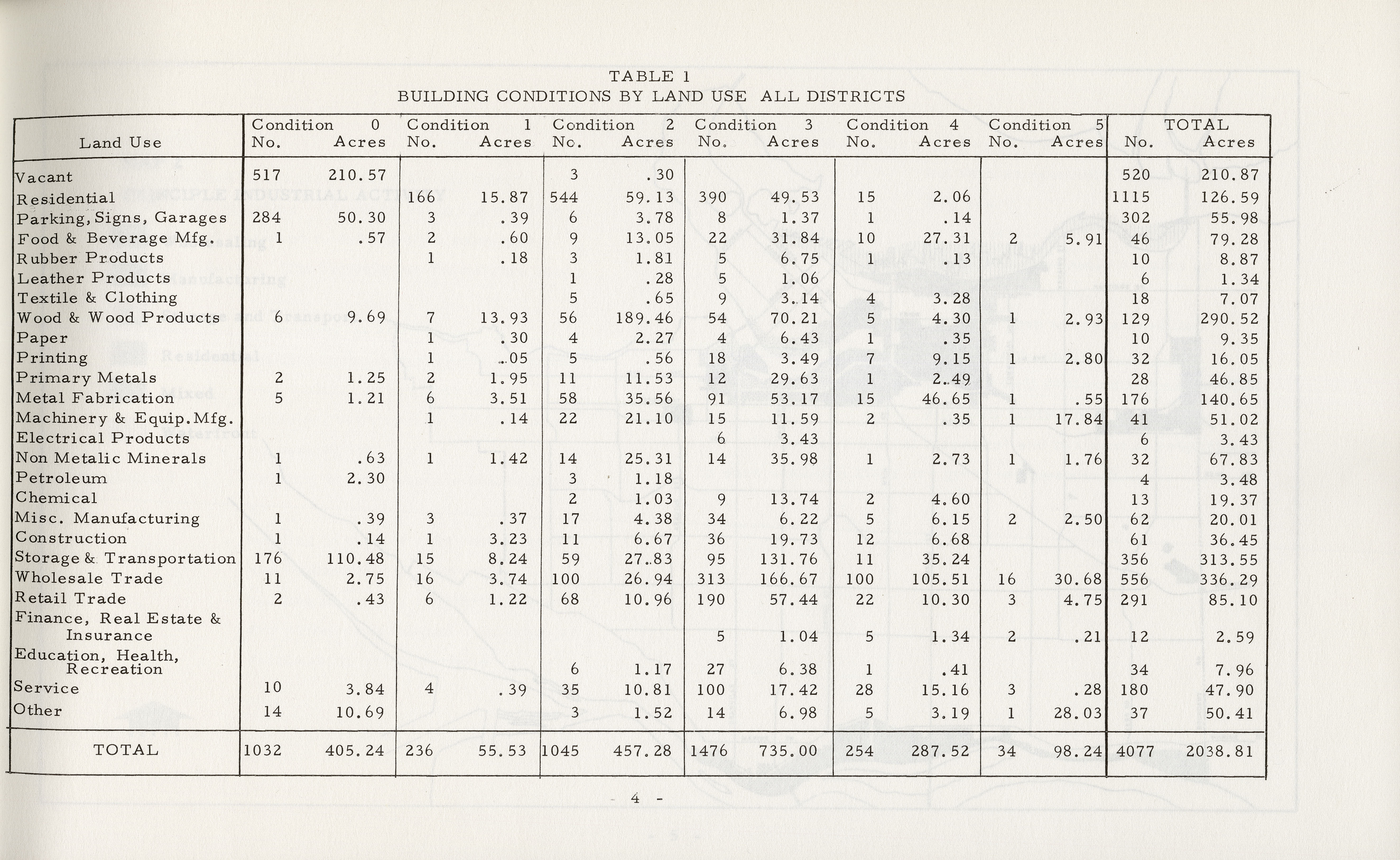
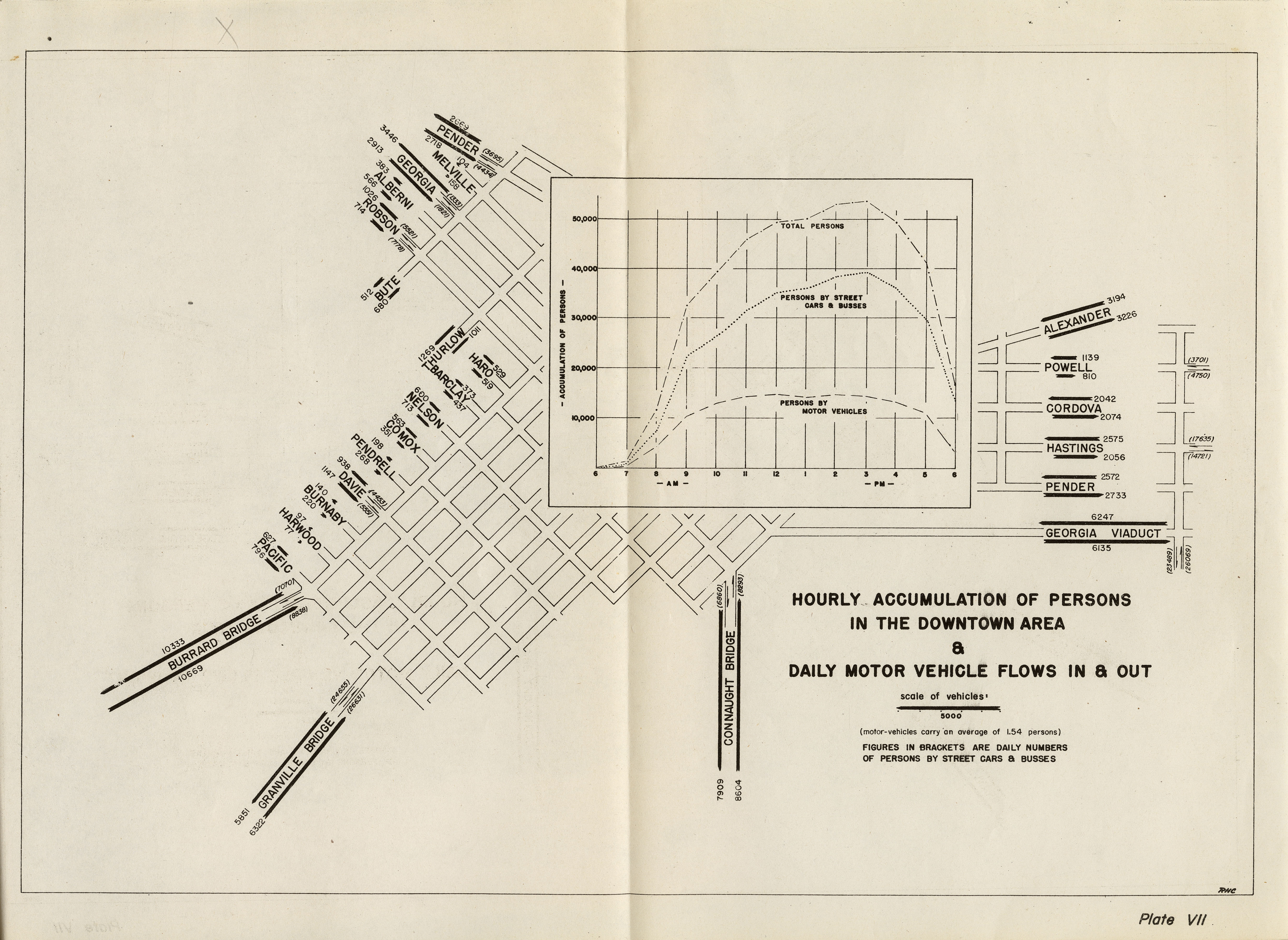
The reports and other documents in the series are rich in historical data on the Vancouver economy, the physical environment of the City and many of its neighbourhoods:
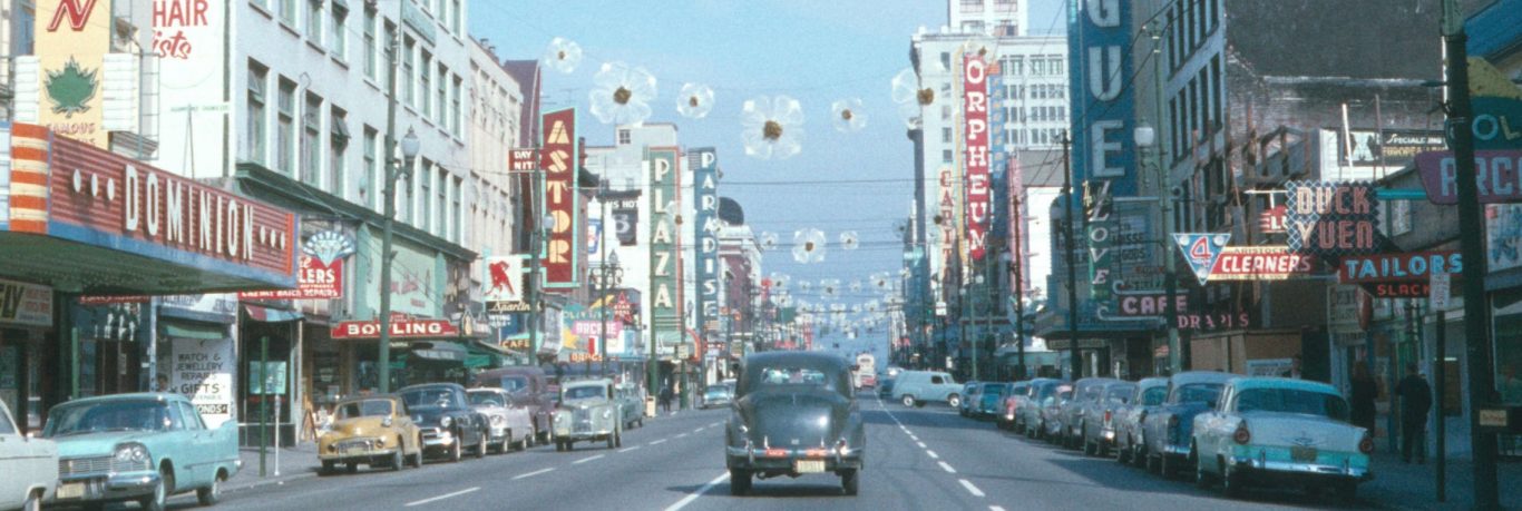
Taking a lateral view, you can see the evolution of concerns from city-wide land use planning in the 1920s through planning as a support function of economic development (transportation planning and urban renewal, especially) in the 1960s…
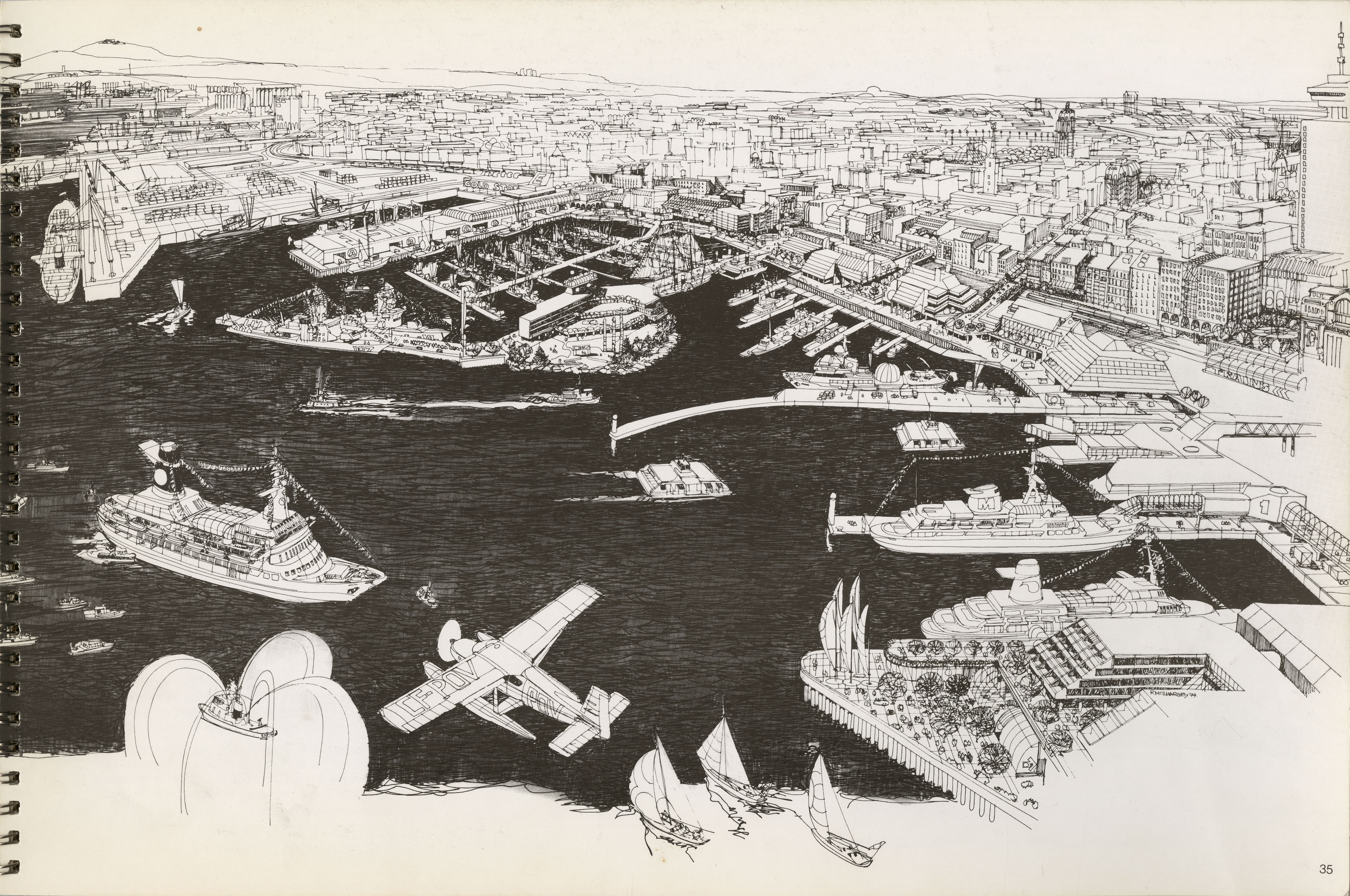
…to redevelopment of the city’s former industrial lands and more neighborhood-focused planning in the 1970s…
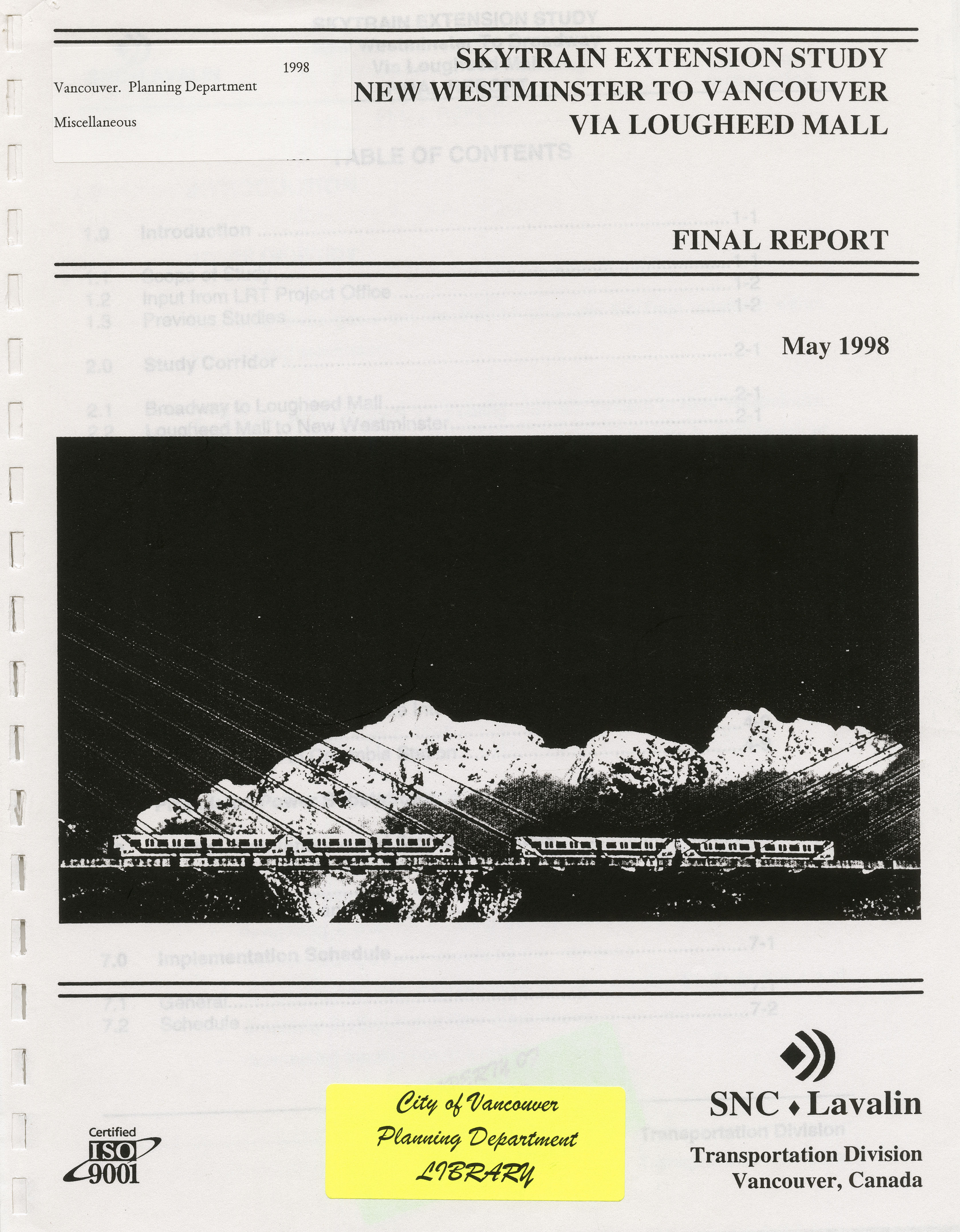
…to planning for Skytrain and Expo in the 1980s, through to managing the explosion of growth that took off in the 1990s.
One-third of the material in the series was not created by City departments; much of this material is not readily available elsewhere. These items include external consultant’s reports; academic studies; unsolicited proposals from engineering companies, developers or architects; reports from other governments and public bodies; and studies sponsored by community groups on a wide variety of issues affecting the city and the lives of people living here.
Overall, the impression gained is that many issues currently concerning the city, planners and citizens have been around for a long time: from the mundanities of street design to housing to regional environmental protection, and everything in between.
The series also contains material that is not Vancouver or Greater Vancouver-specific, including studies and regulations published by other jurisdictions. These would have been used as reference material by staff when developing local responses.
This valuable resource had formerly been made available to members of the broader planning community while still in the custody of the Planning Department, so there has been considerable community interest in getting the series processed since its transfer to the Archives. Processing the series was expedited by the arrival of a Langara Library Tech program student who had been looking for an internship project with us. Kelsey Reimer listed and rehoused about 80% of the series during her internship; the rest was completed by Archives staff.
We hope this material continues to be of use to the general public and the broader planning community, providing historical context to many of the challenges we still continue to face across the city.