Skip to content
AuthentiCity
X
  • Home
  • About The Blog
  • About The Bloggers
  • Comment Policy
  • Links
  • RSS
Menu

Property tax assessment maps now available

Posted on April 4, 2019October 6, 2020 by Sharon Walz

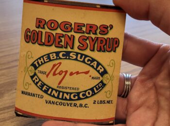
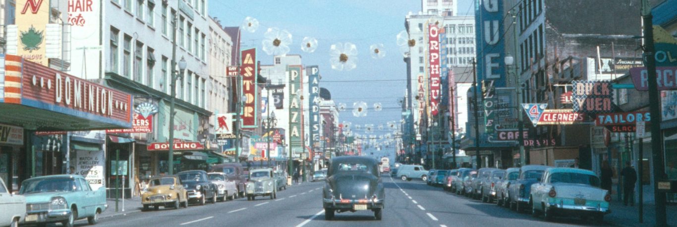
With a nod to international Records and Information Management Month, we’re pleased to announce an addition to the always-popular tax assessment records: the Assessment Division’s Property tax assessment map series is now available to researchers.

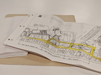
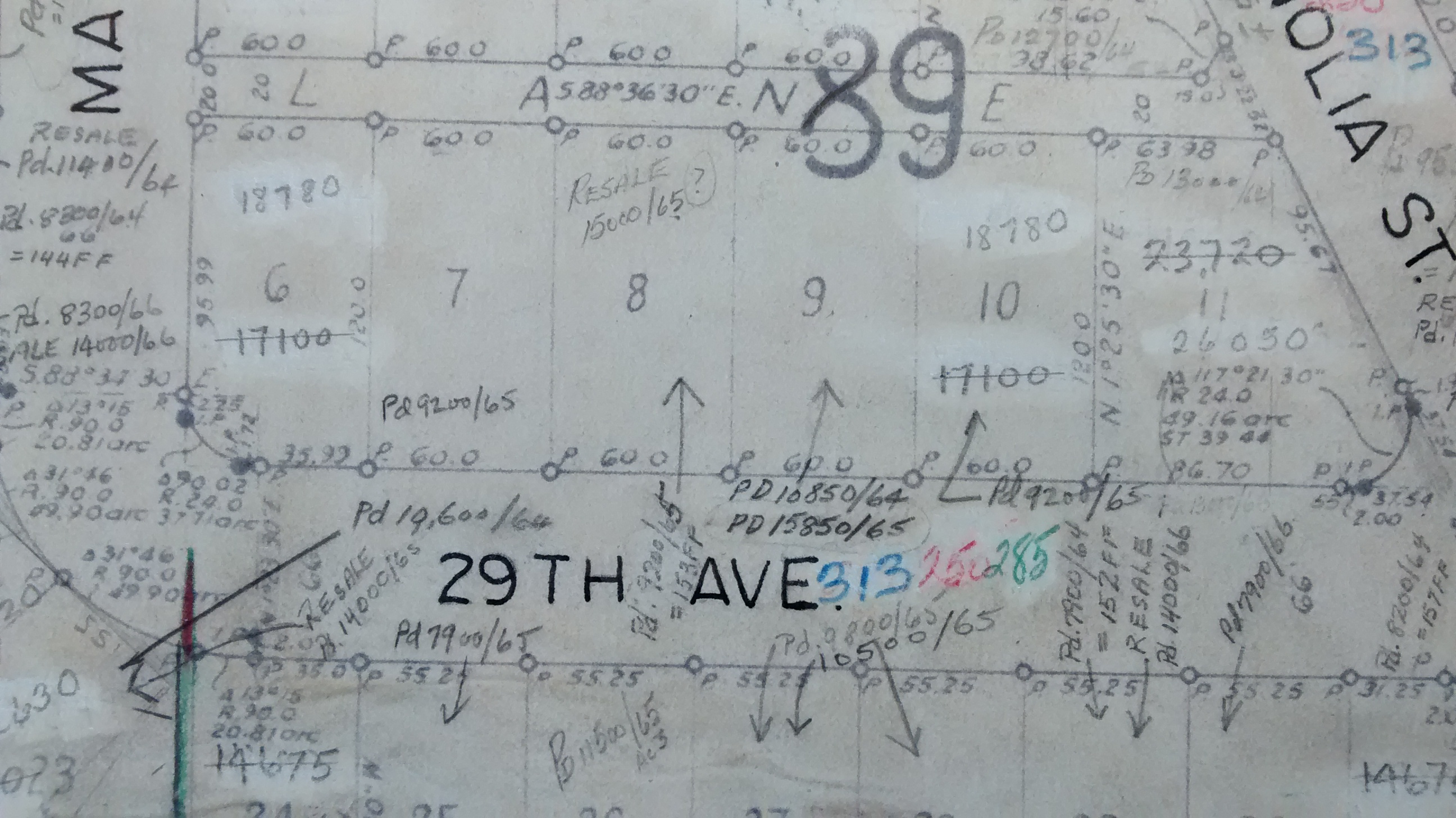
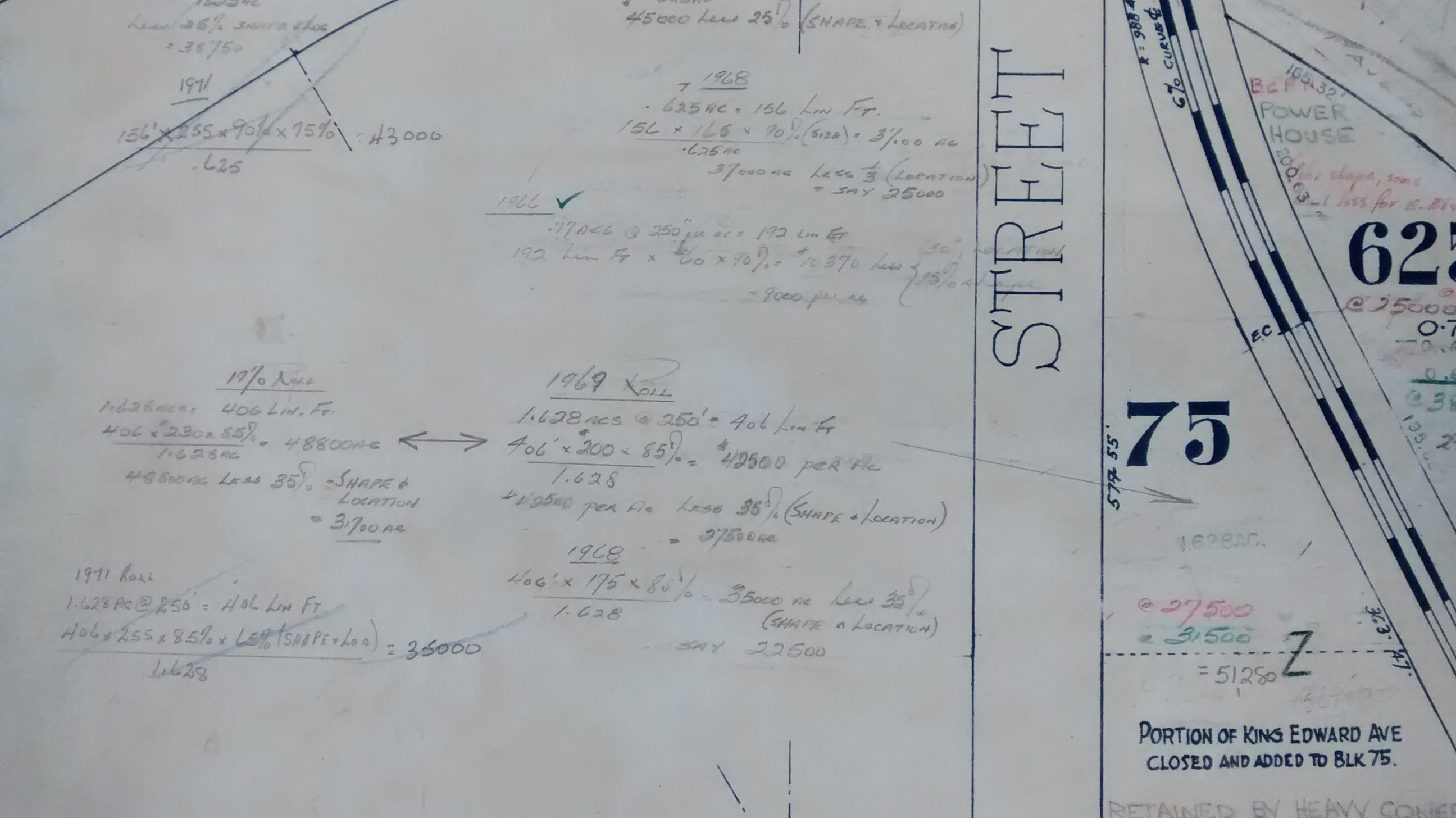
The maps appear to have been used to document information that was used by Assessment Division staff to calculate assessed property value for tax purposes. The maps consist of copies of sectional plans created by the City’s Engineering Department, which have been pasted onto board backing for strength.

The condition of the maps indicates they were heavily used by staff, and the maps contain multiple years’ worth of data.

Assessment map no. 117 – Alexandra Street to Matthews Avenue to Arbutus Street to 29th Avenue. Reference code: COV-S711: LEG2282.192. Photo: Sharon Walz

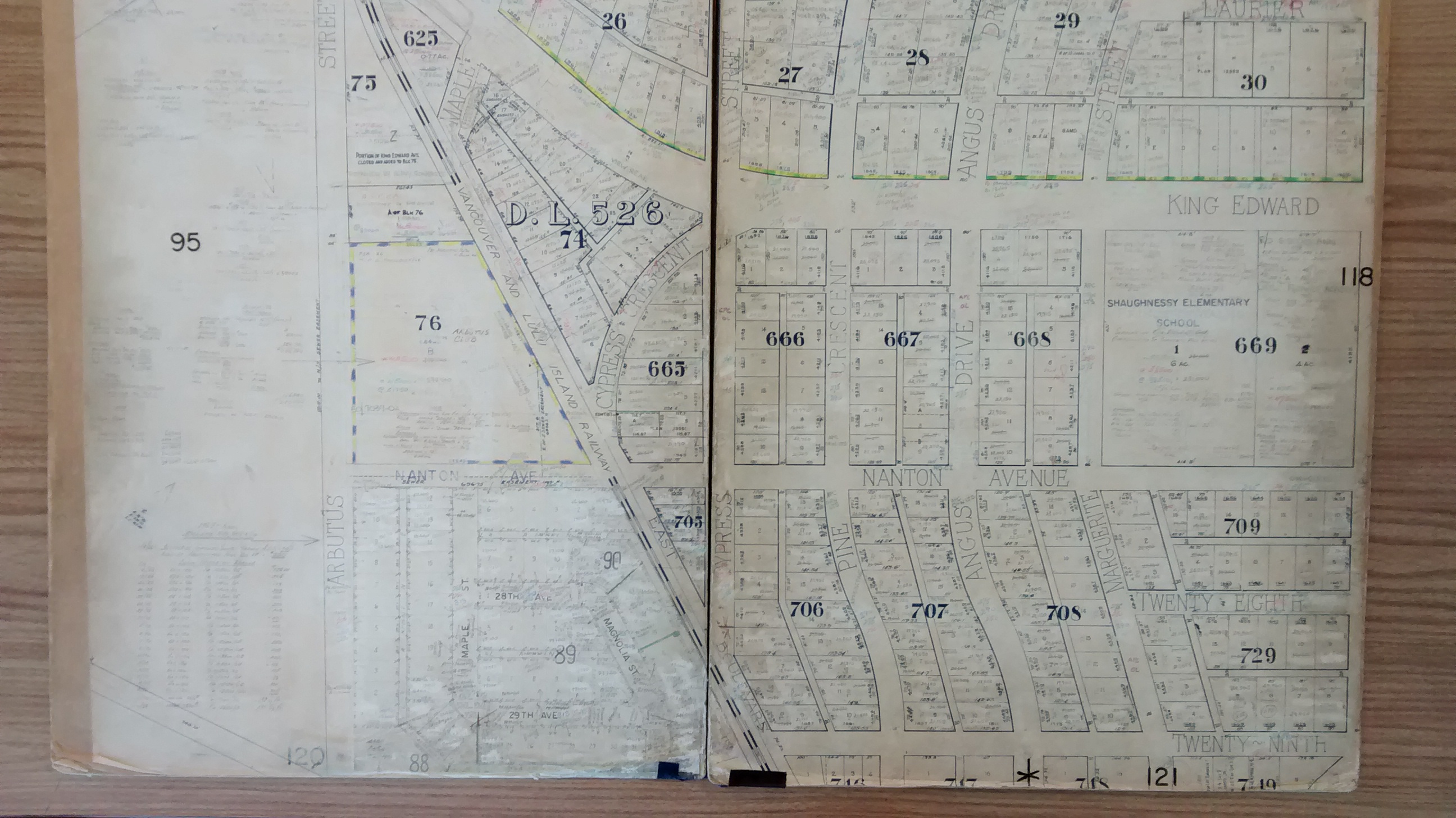
The maps are heavily annotated with property-by-property information, including:

Lot square footage information:

Assessment map no. 117 – Detail showing Blocks 28-30 and 34 of DL 526. Reference code: COV-S711: LEG2282.192. Photo: Sharon Walz

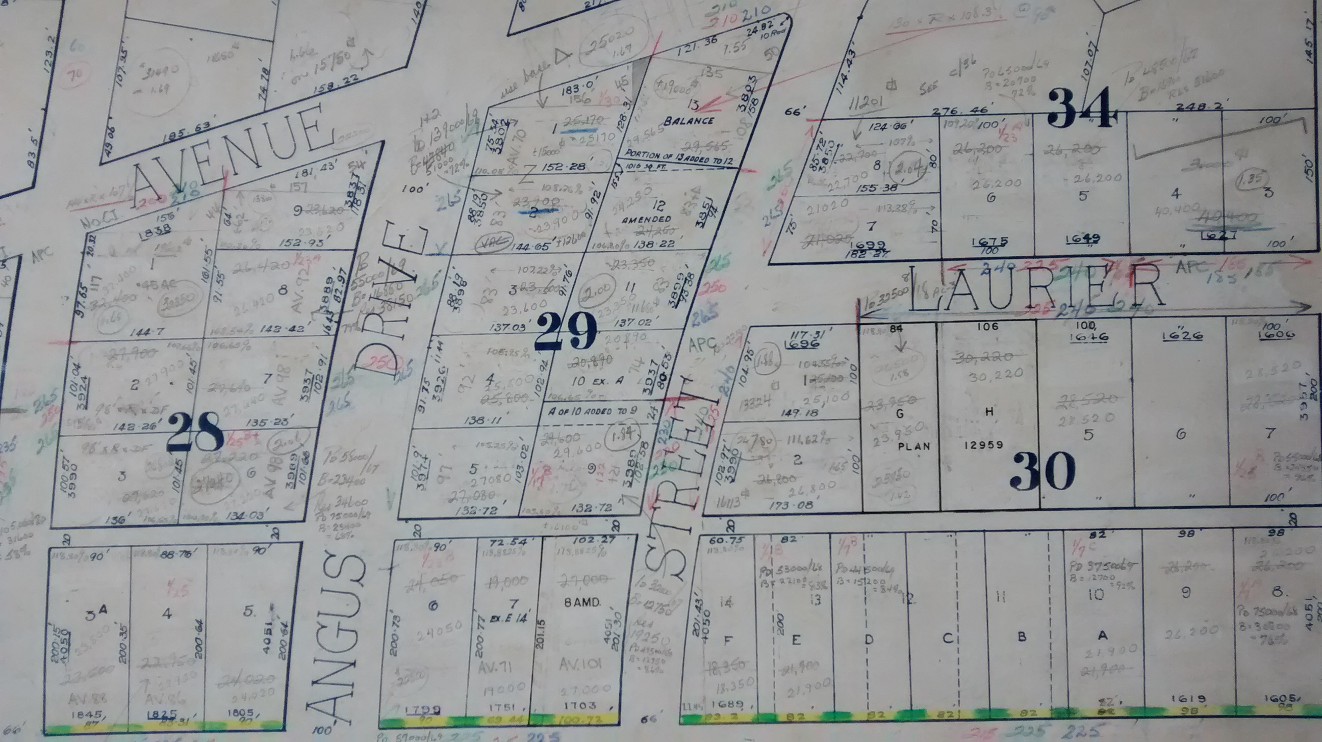
Sale prices of property transactions, often for multiple years:

Assessment map no. 117 – Detail showing part of Block 89 of DL 526. Reference code: COV-S711: LEG2282.192. Photo: Sharon Walz

And sometimes rough assessment calculations:

Assessment map no. 117 – Detail showing part of Blocks 75 and 625 of DL 526 (just south of Arbutus Street and King Edward Avenue). Reference code: COV-S711: LEG2282.192. Photo: Sharon Walz

For many of the maps, we have two versions: one containing information from ca. 1960 to the early 1970s, then a second for the last few years before the City’s responsibility for property tax assessment was transferred to the Province of British Columbia in 1977.

Coverage of the city appears to be virtually complete, though maps for some of the industrial lands adjacent to the Fraser River, especially on the west side, were not included in the transfer. As the maps do not have any naming information on them other than the map numbers, we applied our own naming convention for the sheets: using the names of delineating streets or physical features, in order of East to North to West to South.

Unfortunately, we are unable at this time to digitize this series of maps; the large majority of them require extensive conservation treatment before it would be safe to pass them through our scanner.

We hope this addition to the assessment records is useful for your research, and add another dimension to the history of the city’s development.

Posted in HoldingsTagged maps

Post navigation

Paul Yee photographs and audio recordings now available
The Henry Mole Diaries: Chronicling a pioneer, farmer and councillor

Related Post

  • Council chambers during a meeting in progress, 1949. The City Clerk is at the desk in front of the Mayor, taking the minutes. Reference code: COV-S62-: CVA 296-350 Finding Your Way Through City Council Minutes
  • Sewer permit card for the 4200 block of Atlin Street. Reference code: COV-S723-F07 Records Roundup IV
  • Spread of food at Miss P.N.E. Welcome Banquet, 1968. Reference code: AM281-S8-: CVA 180-4724 Happy Holidays!
  • Lighting up the province: Neon Products design records now available
  • UBC Headlands redevelopment, 1979. Reference Code: AM1194-S7-F1118 : 1993-060.4851 Visions of the Good Life: Landscape architecture of Desmond Muirhead, Clive Justice & Harry Webb
  • A full box, labeled and ready to travel More Vancouver Sun Photographic Negatives Available in the Reading Room!

Leave a Reply

Your email address will not be published. Required fields are marked *

Theme Design & Developed By OpenSumo
  • Home
  • About The Blog
  • About The Bloggers
  • Comment Policy
  • Links
  • RSS