Thanks to funding from the British Columbia History Digitization Program, we’ve completed a project to digitize 512 maps and plans in our holdings. Here are some highlights from the project. We’ve provided links to descriptions in our database so you can click through to the full-resolution versions of the maps if you’d like to examine them in detail. Here’s the link for the map below.
The project makes these maps available to everyone quickly online, and makes them easy to re-use. It reduces damage to the oversized originals due to handling, as they no longer have to be retrieved from storage. Very light-sensitive materials, like blueprints, may be kept in the dark so they don’t fade.
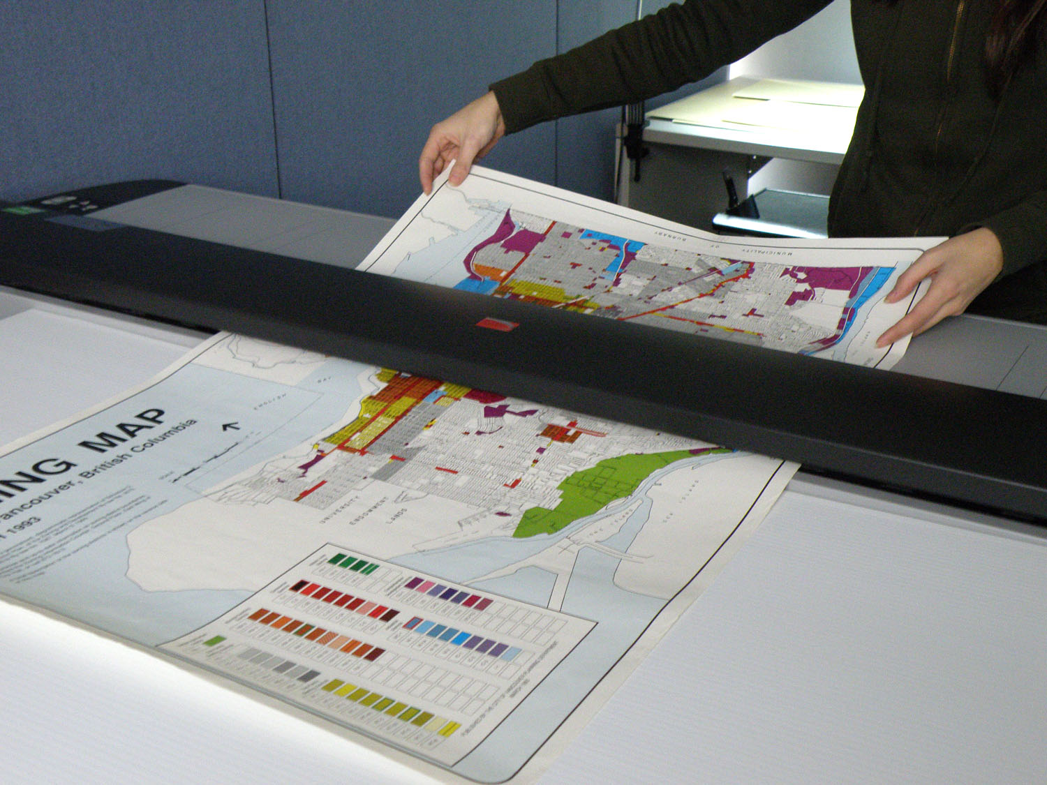
Before the maps are scanned, we clean them as much as possible and then repair any tears that would make the map hard to understand or catch in the scanner. The maps need to be flattened to remove buckling or folds so that all the information can be captured.
We have a large-format scanner that will take objects up to 54 inches wide and 0.6 inches thick. Maps in good shape can be scanned on their own, but if they are especially delicate or have a bumpy surface they will have to be enclosed in an acetate sheet during the scan.
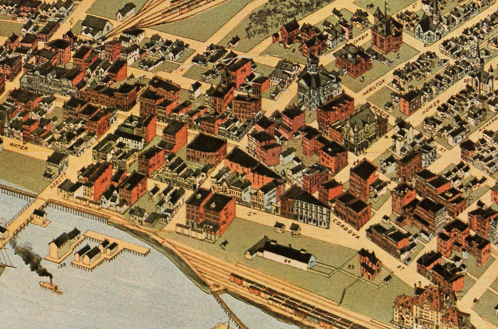
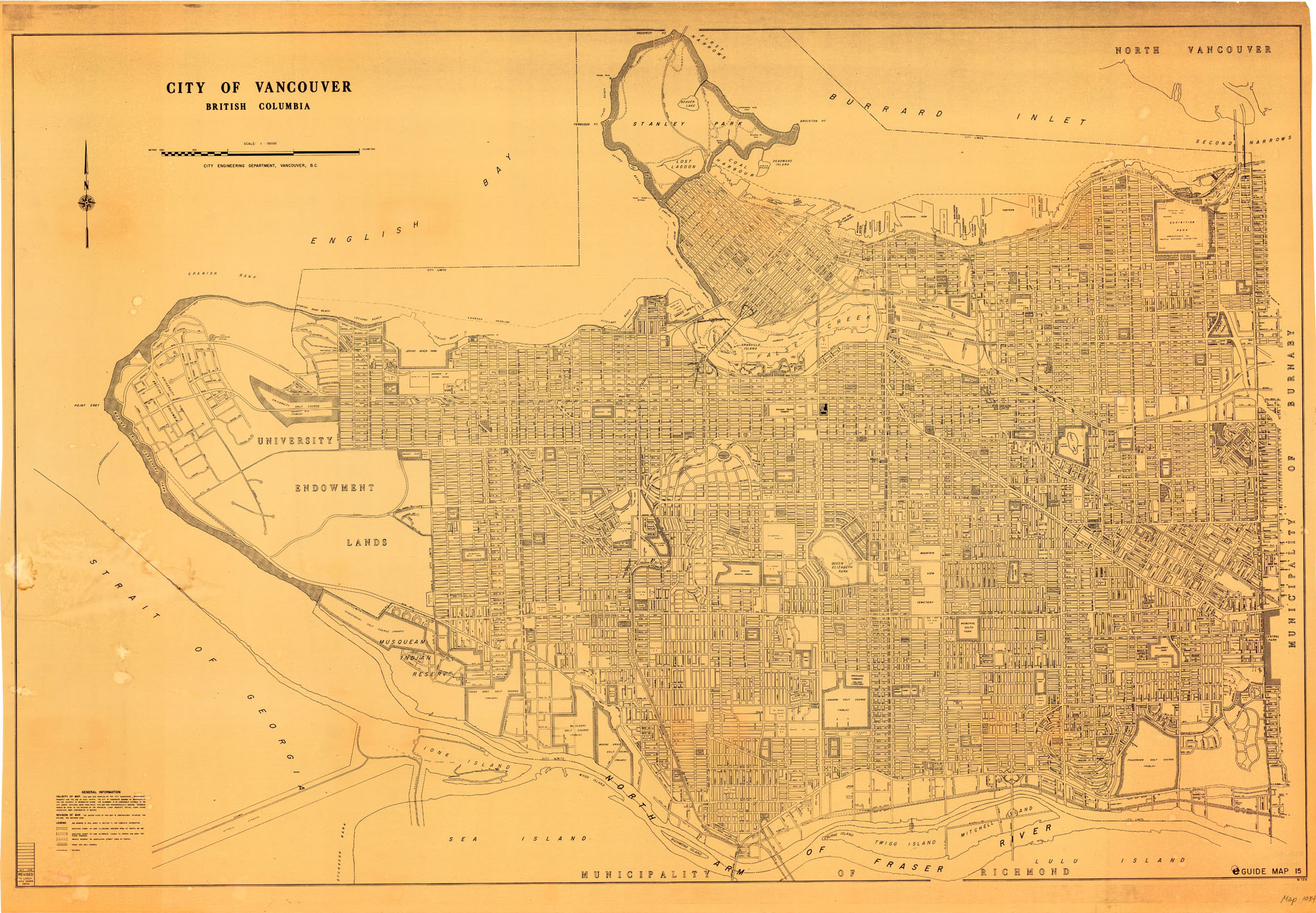
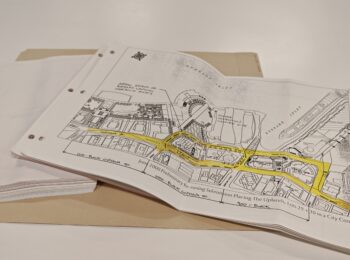
Many of the maps that were created for City projects used standard base maps created by Engineering, and then added other information.
Here’s a 1978 base map of the entire city (and you can see it full-sized here).
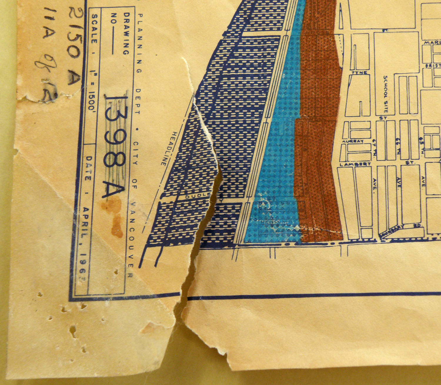
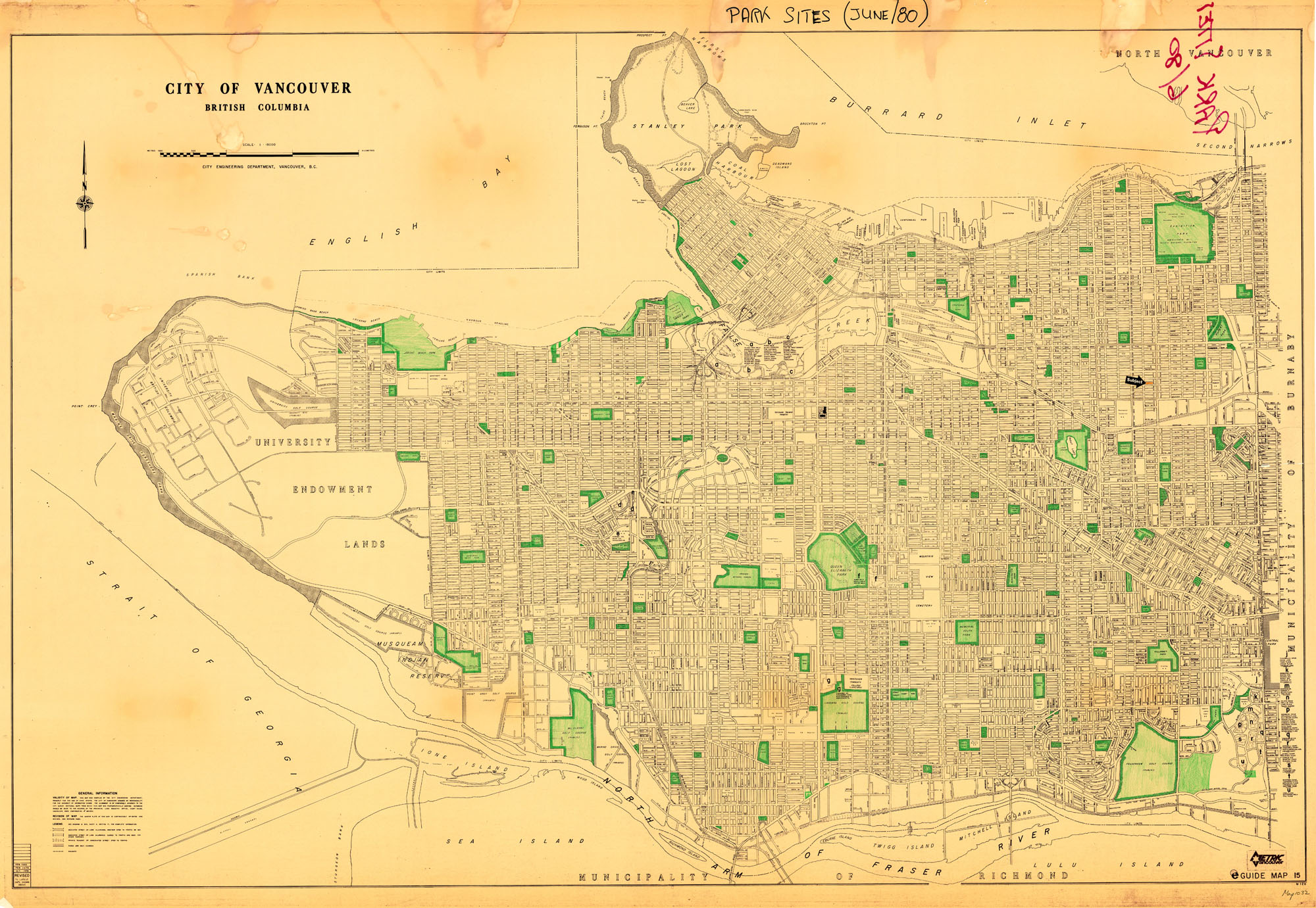
Here’s that 1978 base map revised to 1980 on which all park sites as of June 1980 have been coloured in green pencil (and the full-sized version).
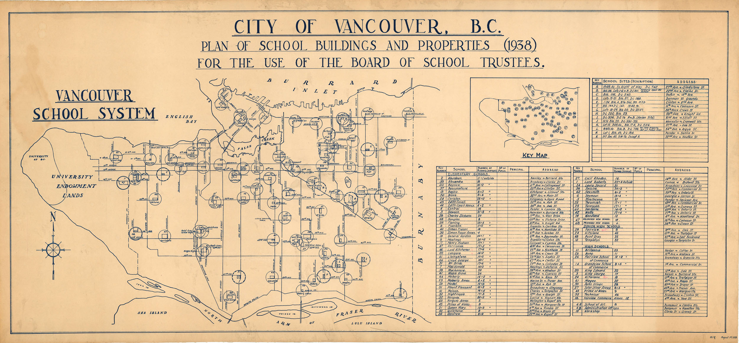
Maps may contain information other than geographical. This 1938 Plan of School Buildings and Properties has a table of additional information about each school: the number of rooms, the street address and the type of school (elementary, junior high or high). (Full-sized version).
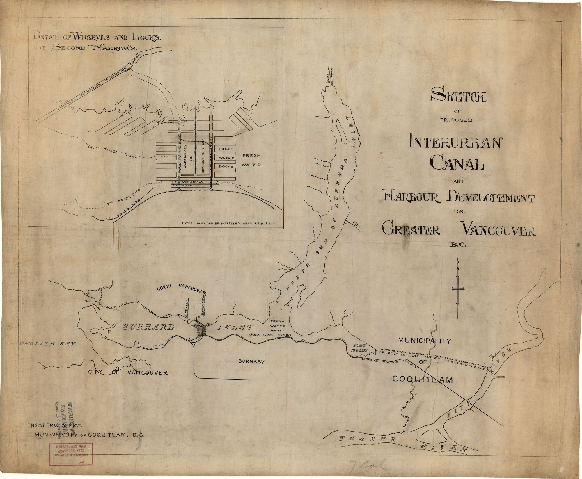
Some of our maps depict plans rather than reality. This shows a proposed canal between Port Moody and the Pitt River, as well as a canal and lock system on Burrard Inlet and a diversion of Seymour Creek. (Full-sized version).
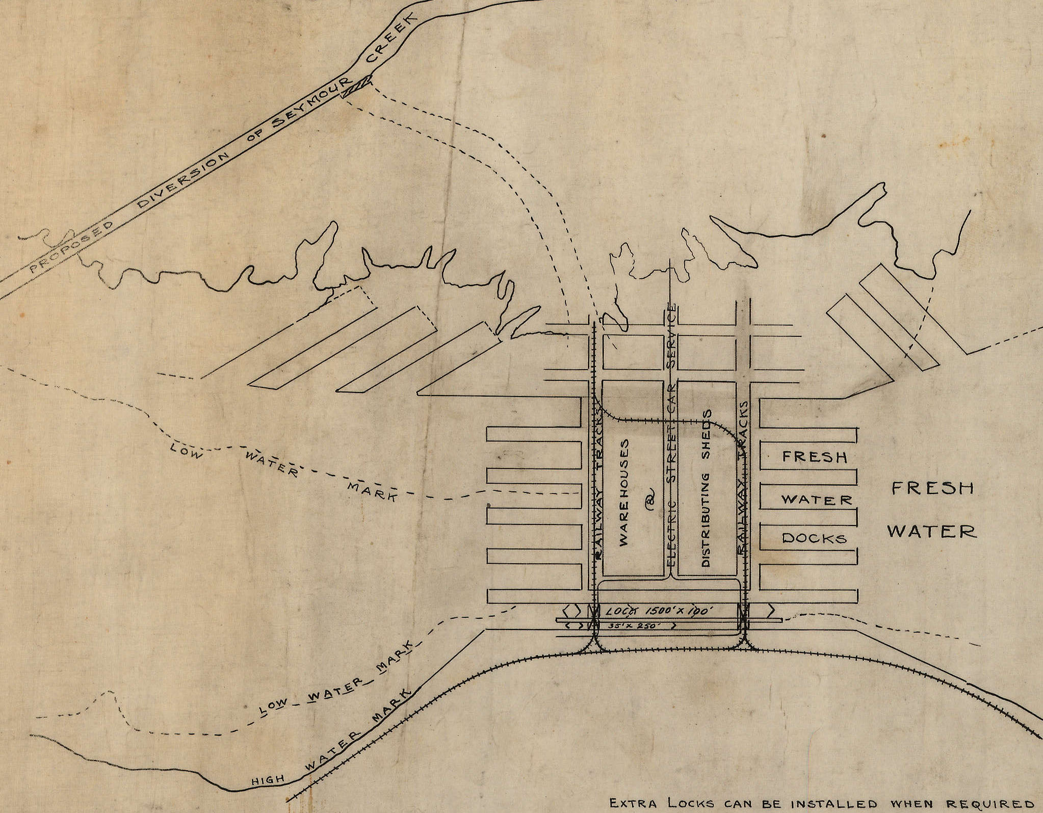
Here’s a detail from the sketch above showing the Burrard Inlet locks.
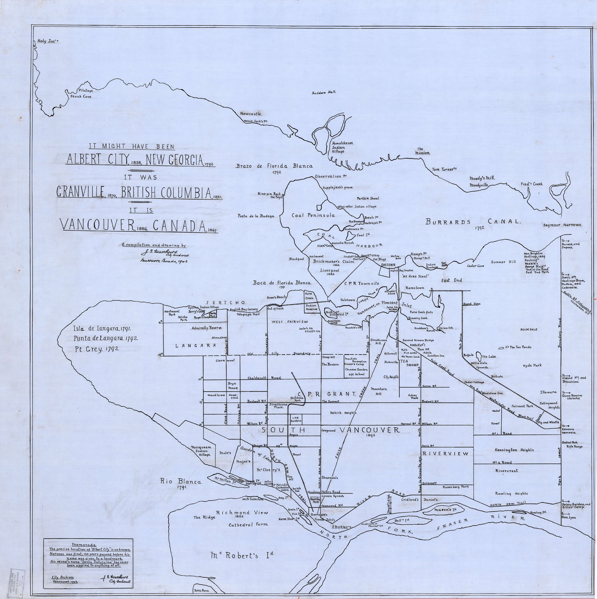
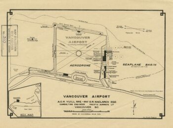
Our first City Archivist, Major Matthews, created maps based on his knowledge of Vancouver’s history. (Full version).
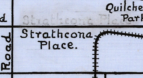
This one was drawn on linen and you can see the weave if you zoom in. You can see how hard it can be to erase information on a linen map without leaving a trace. It’s obvious where the name “Strathcona Place” used to be.
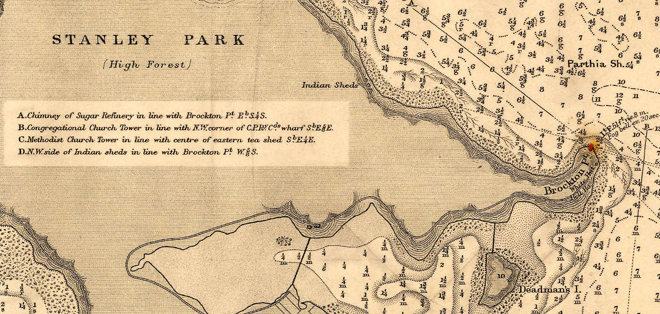
We also have some nautical charts. Here’s one from 1891 that shows lighthouses (in red), the depth of the water, what’s under the water (mud, shells, rock, etc), and other useful navigational aids. (Full version).
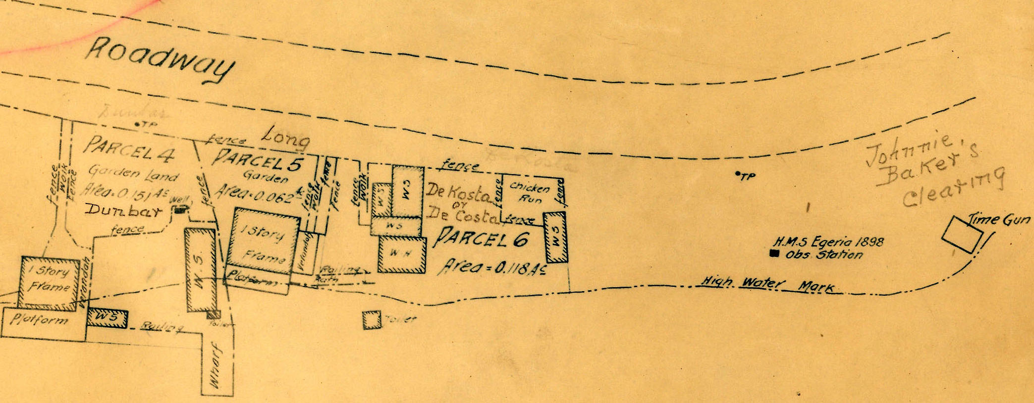
Here’s a detailed look at the land on which people were living in Stanley Park near Brockton Point in 1934. (Full version).
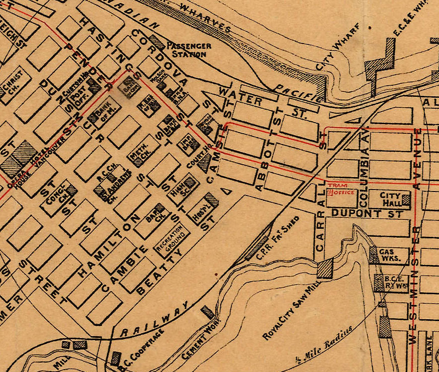
This tourist guide from 1898 helped the traveler by showing transportation (ship, rail, electric tram) and services (customs, post office, hospital, churches, Hotel Vancouver, Molson Bank) rather than attractions. (Full version).
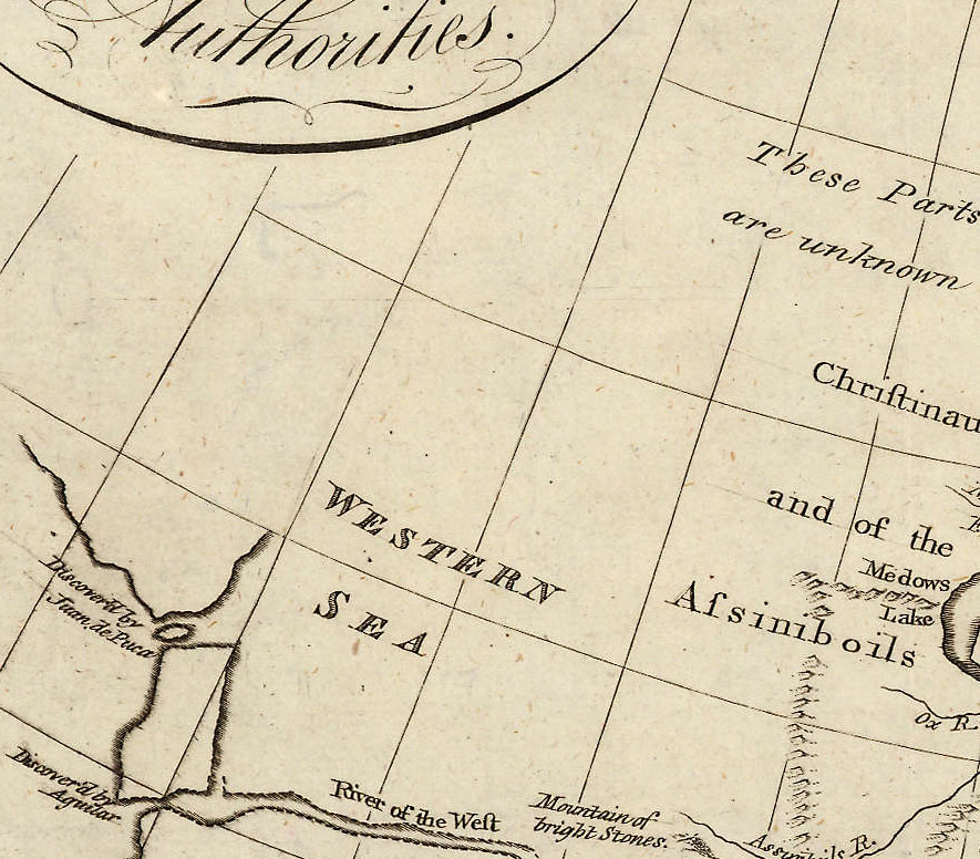
We even have maps that are so old that Vancouver does not appear. This 1787 map, despite being from the “latest and best authorities”, has a big gap where most of British Columbia should be. (Full version).
Have a project that uses one of these maps? Let us know! We love to hear how our holdings are being used.
This digitization project was made possible by funding from the British Columbia History Digitization Program at the Irving K. Barber Learning Centre, University of British Columbia.

Thanks for sharing these and making them available for all to use!