Skip to content
AuthentiCity
X
  • Home
  • About The Blog
  • About The Bloggers
  • Comment Policy
  • Links
  • RSS
Menu

Our digitized maps are now available in TIF format

Posted on July 2, 2015October 7, 2020 by Sue Bigelow

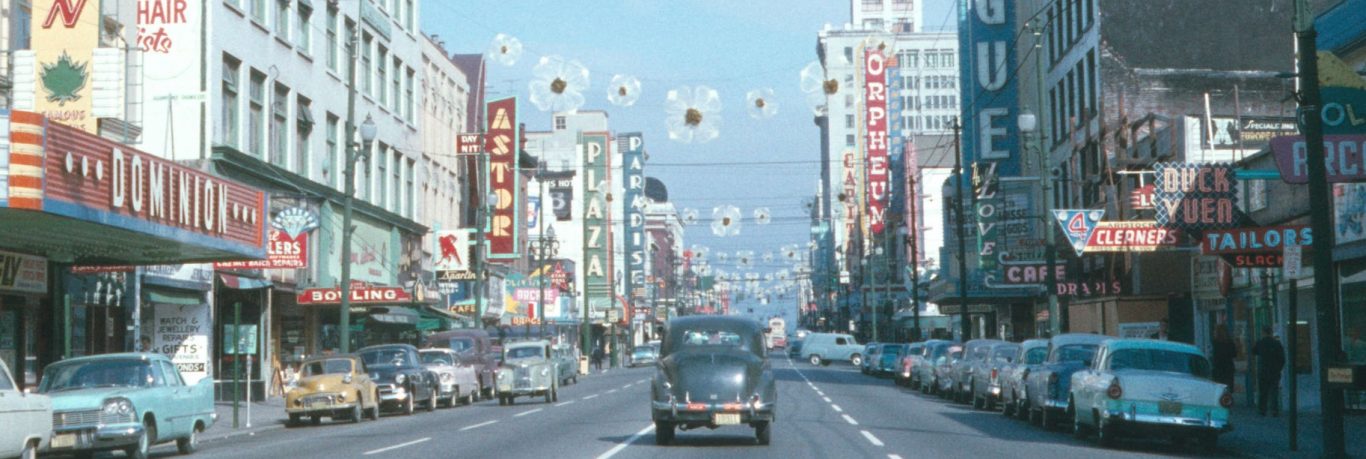
This post is of special interest to the mapping community and may be too technical for some researchers.

We digitize all of our images—photographs, maps and text—as TIFF master files, which are processed through our digital preservation system and preserved in our secure digital storage. We have been making all our digitized images available to researchers in our online search in JPG format. It allows us to make high-resolution files available in a fairly small size so they can be opened and viewed quickly. The quality is good enough for most uses.

Clicking on this map image will bring up the high-resolution JPG version, which can then be downloaded.
Clicking on this map image will bring up the high-resolution JPG version, which can then be downloaded. Note the usual descriptive metadata below the image.

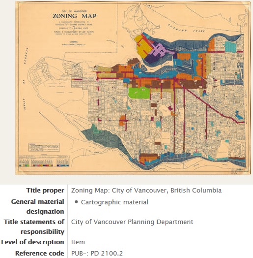
The mapping community has told us that JPG files are not good enough for their use. TIF or PNG formats give the best results when manipulating files in mapping software. The original scanned files, without any compression artifacts, would be the most useful.

To support the use and re-use of these valuable resources by everyone, we’re making losslessly compressed versions of the original TIFFs of our scanned maps available for download. We’ve added a link to the TIFF of a map to our online search as part of the descriptive record for that map.

Scroll down to find the link to the TIFF on the City’s FTP site.
Scroll down the description to find the link to the TIFF on the City’s FTP site.

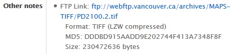
So that you can verify that the file downloaded correctly and completely, we’ve included the full file size and the MD5 checksum.

We’d like to thank City Information Technology, whose recent upgrade of the City’s FTP site made it possible for us to make the files available this way.

Posted in DigitizationTagged digitization, maps, open government, open source

Post navigation

Microfilm Scanners
Association of Canadian Archivists Conference 2015

Related Post

  • Preserving Fronds, not fonds: The Conservation and Digitization of a Fern Album
  • Caught in a bind: Digitization with an Atiz book scanner
  • Examples of ornate cases: (Left) Tooled leather covering on a wooden case. Reference code: AM1368-S3-: 2000-018.810. (Right) A Union case. Reference code: AM236. Photo: Dorcas Tong. Just Encased: A Spotlight on the Conservation Treatment and Digitization of Cased Photographs
  • 57 West Cordova Street - Travellers Hotel and adjacent parking lot. Reference code: COV-S644-: CVA 1095-09864 From the Brambly Apartments to Blood Alley, Heritage Inventory has it all!
  • But wait, there’s more! More Heritage Inventory photographs now available
  • Hamber family photos now available online

4 thoughts on “Our digitized maps are now available in TIF format”

  1. Niall Williams says:
    July 2, 2015 at 13:30

    Sweet! Great job in expanding the usefullness of these documents for the public. Vancouver Archives is really useful service for me in my work.

  2. Michael McCarthy says:
    July 2, 2015 at 17:09

    Thank you!

  3. Jim says:
    November 13, 2015 at 07:38

    I don’t see a link to the search page for these online images. Can you provide it?

    Thanks

  4. Heather Gordon says:
    November 13, 2015 at 10:09

    Thanks for pointing this out. We’ve added a link in the post to our online search. It is http://searcharchives.vancouver.ca/ The advanced search page is at http://searcharchives.vancouver.ca/search/advanced

Leave a Reply

Your email address will not be published. Required fields are marked *

Theme Design & Developed By OpenSumo
  • Home
  • About The Blog
  • About The Bloggers
  • Comment Policy
  • Links
  • RSS